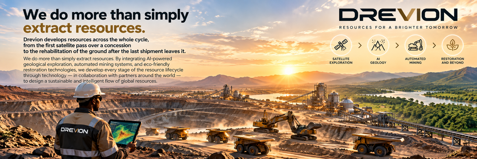
"We do more than simply extract resources."
Drevion develops resources across the whole cycle, from the first satellite pass over a concession to the rehabilitation of the ground after the last shipment leaves it.
We do more than simply extract resources. By integrating AI-powered geological exploration, automated mining systems, and eco-friendly restoration technologies, we develop every stage of the resource lifecycle through technology — in collaboration with partners around the world — to design a sustainable and intelligent flow of global resources.
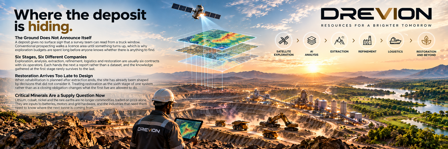
A deposit gives no surface sign that a survey team can read from a truck window. Conventional prospecting walks a licence area until something turns up, which is why exploration budgets are spent long before anyone knows whether there is anything to find.
Exploration, analysis, extraction, refinement, logistics and restoration are usually six contracts with six operators. Each hands the next a report rather than a dataset, and the knowledge gathered at the first stage rarely survives to the last.
When rehabilitation is planned after extraction ends, the site has already been shaped by decisions that did not consider it. Treating restoration as the sixth stage of one system rather than as a closing obligation changes what the first five are allowed to do.
Lithium, cobalt, nickel and the rare earths are no longer commodities traded on price alone. They are inputs to batteries, motors and grid hardware, and the industries that need them need to know where the next tonne is coming from.
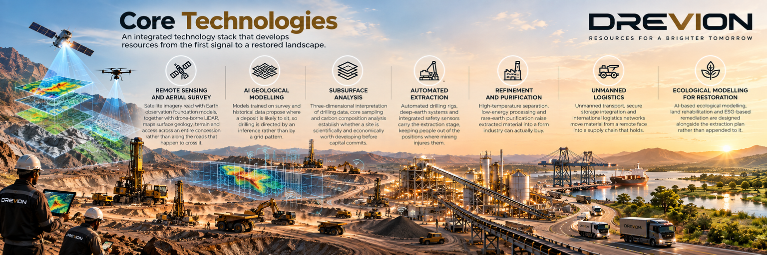
Satellite imagery read with Earth observation foundation models, together with drone-borne LiDAR, maps surface geology, terrain and access across an entire concession rather than along the roads that happen to cross it.
Models trained on survey and historical data propose where a deposit is likely to sit, so drilling is directed by an inference rather than by a grid pattern.
Three-dimensional interpretation of drilling data, core sampling and carbon composition analysis establish whether a site is scientifically and economically worth developing before capital commits.
Automated drilling rigs, deep-earth systems and integrated safety sensors carry the extraction stage, keeping people out of the positions where mining injures them.
High-temperature separation, low-energy processing and rare-earth purification raise extracted material into a form industry can actually buy.
Unmanned transport, secure storage integration and international logistics networks move material from a remote face into a supply chain that holds.
AI-based ecological modelling, land rehabilitation and ESG-based remediation are designed alongside the extraction plan rather than appended to it.
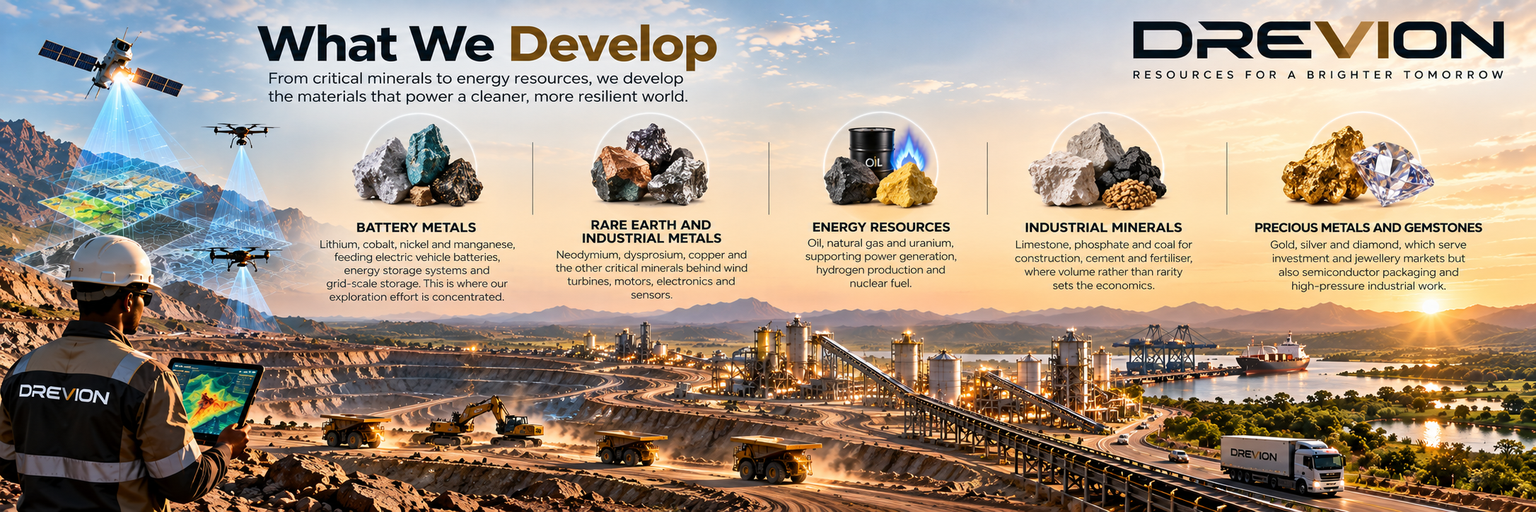
Lithium, cobalt, nickel and manganese, feeding electric vehicle batteries, energy storage systems and grid-scale storage. This is where our exploration effort is concentrated.
Neodymium, dysprosium, copper and the other critical minerals behind wind turbines, motors, electronics and sensors.
Oil, natural gas and uranium, supporting power generation, hydrogen production and nuclear fuel.
Limestone, phosphate and coal for construction, cement and fertiliser, where volume rather than rarity sets the economics.
Gold, silver and diamond, which serve investment and jewellery markets but also semiconductor packaging and high-pressure industrial work.
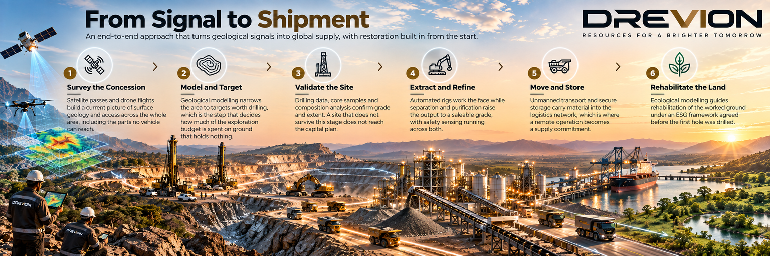
Satellite passes and drone flights build a current picture of surface geology and access across the whole area, including the parts no vehicle can reach.
Geological modelling narrows the area to targets worth drilling, which is the step that decides how much of the exploration budget is spent on ground that holds nothing.
Drilling data, core samples and composition analysis confirm grade and extent. A site that does not survive this stage does not reach the capital plan.
Automated rigs work the face while separation and purification raise the output to a saleable grade, with safety sensing running across both.
Unmanned transport and secure storage carry material into the logistics network, which is where a remote operation becomes a supply commitment.
Ecological modelling guides rehabilitation of the worked ground under an ESG framework agreed before the first hole was drilled.
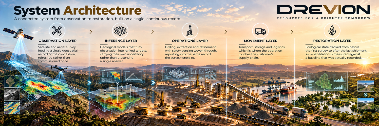
Satellite and aerial survey feeding a single geospatial record of the concession, refreshed rather than commissioned once.
Geological models that turn observation into ranked targets, carrying their own uncertainty rather than presenting a single answer.
Drilling, extraction and refinement with safety sensing woven through, reporting into the same record the survey wrote to.
Transport, storage and logistics, which is where the operation touches the customer's supply chain.
Ecological state tracked from before the first survey to after the last shipment, so rehabilitation is measured against a baseline that was actually recorded.
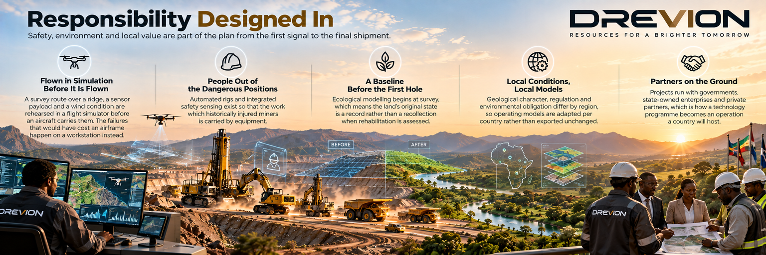
A survey route over a ridge, a sensor payload and a wind condition are rehearsed in a flight simulator before an aircraft carries them. The failures that would have cost an airframe happen on a workstation instead.
Automated rigs and integrated safety sensing exist so that the work which historically injured miners is carried by equipment.
Ecological modelling begins at survey, which means the land's original state is a record rather than a recollection when rehabilitation is assessed.
Geological character, regulation and environmental obligation differ by region, so operating models are adapted per country rather than exported unchanged.
Projects run with governments, state-owned enterprises and private partners, which is how a technology programme becomes an operation a country will host.

We hold Prithvi-EO 2.0 and OlmoEarth, two Earth observation foundation models. A concession can be read from satellite imagery for surface change, exposed geology and access before a team is sent to stand on it.
We hold PX4-Autopilot for flight control and QGroundControl as the ground station. A survey aircraft flies a planned grid and returns imagery and telemetry to an operator who never leaves the camp.
We hold Pegasus Simulator, XTDrone and gym-pybullet-drones. A route over a ridge, a sensor payload and a wind condition are flown in simulation first, so failures happen on a workstation.
We hold GAAS for autonomous flight, DroneBridge for the radio link between aircraft and ground, and esp-fc for small flight controller firmware.
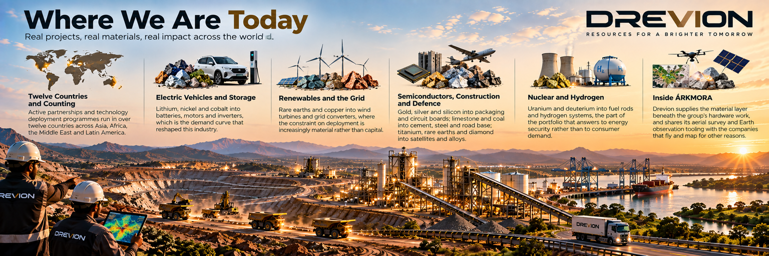
Active partnerships and technology deployment programmes run in over twelve countries across Asia, Africa, the Middle East and Latin America.
Lithium, nickel and cobalt into batteries, motors and inverters, which is the demand curve that reshaped this industry.
Rare earths and copper into wind turbines and grid converters, where the constraint on deployment is increasingly material rather than capital.
Gold, silver and silicon into packaging and circuit boards; limestone and coal into cement, steel and road base; titanium, rare earths and diamond into satellites and alloys.
Uranium and deuterium into fuel rods and hydrogen systems, the part of the portfolio that answers to energy security rather than to consumer demand.
Drevion supplies the material layer beneath the group's hardware work, and shares its aerial survey and Earth observation tooling with the companies that fly and map for other reasons.
"A concession is read before it is opened, and the ground left behind is measured against what was recorded there first."
DREVION — Intelligent Resource Development.